2022.07.27
The signboards was set up to the Japan Heritage of Hinenosho.
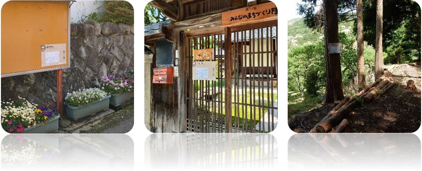
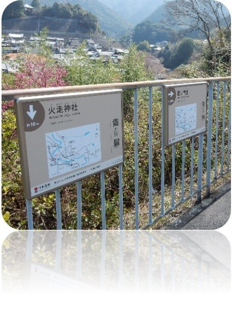
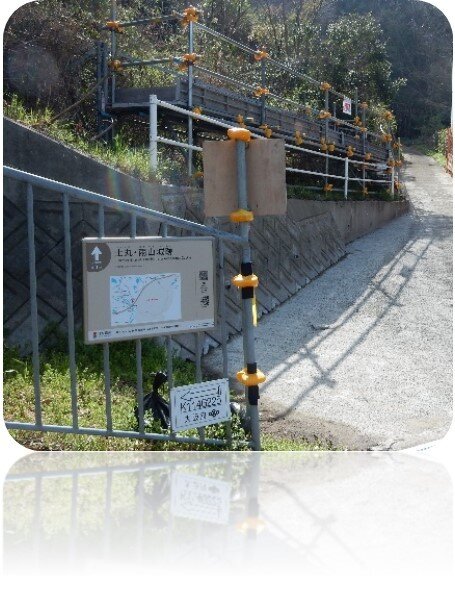
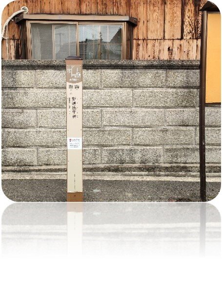
In order to enable you to more smoothly visit the Japan Heritage Hinenosho. We have set up many signboards and pillar signs for you.Guidebooks are printed on all signs and posts. It contains a map marking the present location and the sites that the constituent cultural properties.You only need to scan the code to listen to and watch the sound and text of the constituent cultural properties. Please scan the QR code and try it when you visit cultural heritage sites. It contains a map marking the present location and the sites that the constituent cultural properties. You only need to scan the code to listen to and watch the sound and text of the constituent cultural properties.
Please scan the QR code and try it when you visit cultural heritage sites.
Check it out
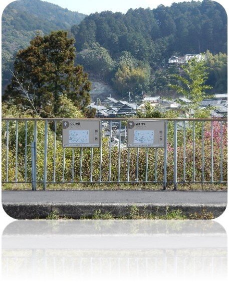
Signboard of Japan Heritage of Ogi area
Installation location:
In front of Ogi Elementary School.
The map of Ogi area shows the sites of cultural heritage and toilets. This is where you can find the location of the signboards in the Ogi area.
Signboard of Former Site of Kosekiji Temple
Installation location:
① Signboard of Kami-ogi Neighborhood Association
② The entrance of OGi HOTAL Minmachi-mura
③ Former Site of Kosekiji Temple
The Masamoto-ko Tabihikitsuke describes the priests of Kosekiji Temple who visited Masamoto at the end of a year and start of a new year. The temple referred to as "Koseki-in" is believed to be the same temple. Priests of the temple lent books to Masamoto and presented him with tea. It is also thought to correspond to "Konyakuji Temple" in a painting created in the Edo Period (1603-1868). However, the temple has been abandoned, and ruins are all that remain now.
The area designated as the former site includes isseki-gorinto dated 1463, a graveside pagoda from the Tensho Era (1573-1592) and other stone objects that can be traced to both the medieval and modern era.
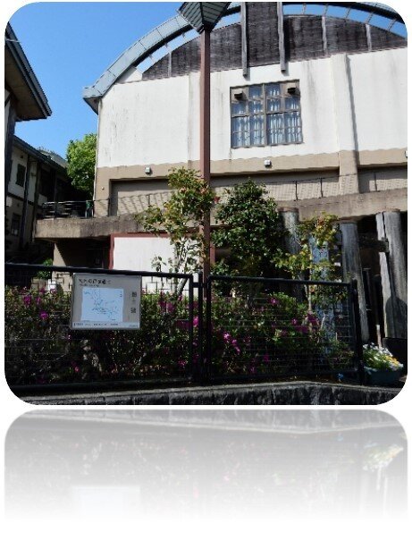
Signboard of Rengeji Temple
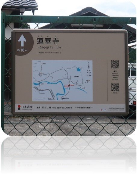
Installation location:
Fence at Rengeji Temple parking lot.
The name "Rengeji Temple" is found in the Masamoto-ko Tabihikitsuke. Within Iriyamada Village, there are two separate Rengeji Temples, one located in Kami-ogi area and one located in Tsuchimaru area. The Kami-ogi location of Rengeji Temple appears in the section concerning Funabuchi Village in the Kujo Family Archives dated 1417, which suggests that it existed during Japan's middle ages.
The temple currently serves as a meeting hall for residents of the Kami-ogi area and hosts Buddhist lecture meetings and other activities. The grounds still contain stone objects, including medieval stone Buddhist images and isseki-gorinto (one-stone five-story pagodastyle gravestones).
Signboard of Yanabu Suspension Bridge
Installation location:
Fence at Rengeji Temple parking lot.
This is the only suspension bridge in the Ogi area. The suspension bridge crosses Kashiigawa River and connects Kami-ogi area to the farmland ahead of Yanabu farm road. Through this suspension bridge, you can go to the Inunakisan.
Signboard of Bishamon-do Temple
Installation location:
Fence at the prefectural road in front of Hibashiri Jinja Shrine.
Although the temple is not mentioned in any archives under the name "Bishamon-do," the low-lying valley where the temple is nested was known as "Goshodani," and the Masamoto-ko Tabihikitsuke refers to the temple as "Goshodani Gathering Place." Its grounds contain numerous stone monuments, including a stone tablet dated 1348. Even today, valley residents hold Buddhist lecture meetings in the temple.
Signboard of Hibashiri Jinja Shrine
Installation location:
Fence at the prefectural road in front of Hibashiri Jinja Shrine.
During the time when Kujo Masamoto resided in Hinenosho, this was the shrine for the four settlements constituting Iriyamada Village (Funabuchi, Shobu, Ogi and Tsuchimaru), and it was also known by the names "Taki Daimyojin Shrine", "Takinomiya Shrine" and "Takimiya Shrine."
Standing on the left of its inner shrine, the inner shrine of Miyuki Jinja Shrine, a sessha (auxiliary shrine) of Hibashiri Jinja Shrine, has also been designated as a National Important Cultural Property.
Signboard of Saikoji Temple
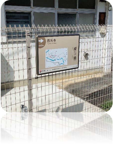
Installation location:
The fence next to the Naka-ogi Neighborhood Association Hall.
There is a Munafuda(building tag) made in 1401 in Saikoji Temple, and the replica is in the Rekishikan Izumisano Museum. Yakushi-do Temple is the building of Sangendo Hipped Roof. Some of the pillars and beams were made of old materials.
Pillar Sign of Enmanji Temple
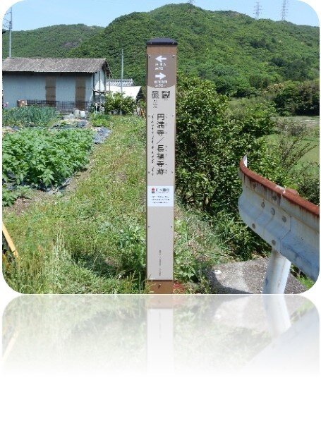
Installation location:
In front of Enmanji Temple.
A journal entry dated 1503 states that residents from Iriyamada Village prayed by reading 10,000 volumes of the Heart Sutra in Enmanji Temple and also made a collective total of 10,000 prayer visits to a shrine. The temple was also used as a place where banto(guards) detained thieves by order of Masamoto. At the time of an intrusion by Shugogata (military of the governor), its fire bell was rung to sound a warning and summon the residents. The temple is now used as a community gathering place for the Shimo-ogi area, and Buddhist lecture meetings are also held there.
Pillar Sign of Tsuchimaru Gokurakuji Temple
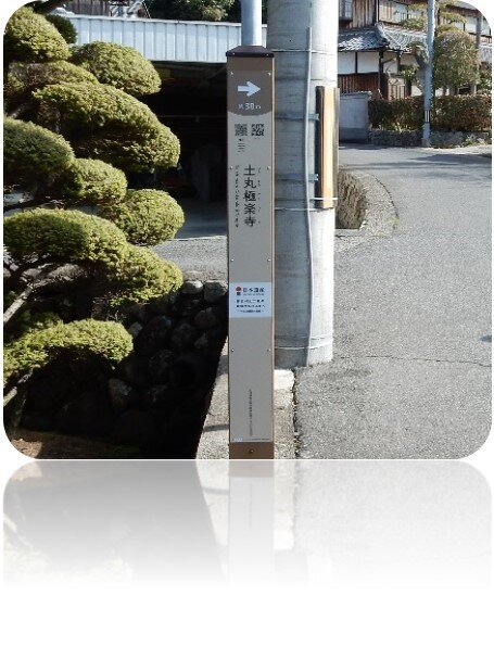
Installation location:
The prefectural road in front of Tsuchimaru Gokurakuji Temple.
The Tsuchimaru Gokurakuji Temple is mentioned in the Kujo family document in 1417. There are records of holding Shusho-e and Hokke Hakko(ceremonial series of eight lectures on the eight scrolls of the Lotus Sutra). At the end of the Heian period, the wooden seated Amitabha tathagata is the original incarnation of the Gokurakuji Temple. A replica of the Buddha is on display at the Rekishikan Izumisano Museum.
Signboard of Former Site of Tsuchimaru Ameyama Castle
Installation location:
The prefectural road in front of Tsuchimaru Ameyama entrance.
The route from Kisyu to Izumi and Kawachi was controlled by Hineno Moriharu of the Northern Court and Hashimoto Masataka of the Southern Court. In the war of the North and South Dynasties, they held the city and fought fiercely for it.
Pillar Sign of Hine Jinja Shrine
Installation location:
Hine Jinja Shrine parking lot.
It is a shrine listed in the Engi-Shiki, and is located where the Kashiigawa River goes out from the hills to the plains. The Masamoto-ko Tabihikitsuke records that a grand festival was held on April 2 every year to organize performances of sarugaku (the precursor of kyogen farces in Noh theater), kurabeuma (horse races), sacred services involving ceremonial archery and other festive events.
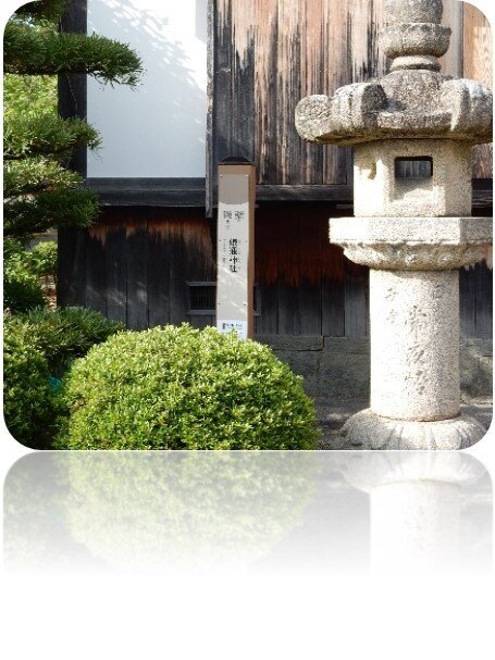
Pillar Sign of Jigen-in Temple
Installation location:
Next to the Higashiue bus stop.
The temple received its official name, "Jigen-in" (the Buddhist name of Kujo Masamoto), from the head priest of Ninnaji Temple in 1665. The grounds contain a two-story pagoda and a main hall erected in the 8th year of Bunei period(1271), which have been designated as a National Treasure and National Important Cultural Property, respectively.
Signboard of Sofukuji Temple
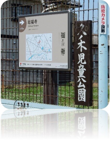
Installation location:
Kunoki Children's Park entrance fence.
Sofukuji Temple is believed to be the Zenrinji Temple depicted in the Painting of Hineno Village. The temple has a Tenmangu shrine on the south side of the grounds, and its inner shrine built in the Ikkensha Kasuga-zukuri style (built to the width of just a single bay at the gable ends) during the Tensho period (1573-1592) has been designated as a National Important Cultural Property.
Pillar Sign of Shindode Ushigami Altar
Installation location:
Next to the Nishiue bus stop and signboard of Nishiue Neighborhood Association
It was a widespread custom in the area currently known as Sennan area that worshippers of cattle deities brought cattle playing active roles in farming and other works to an alter once a year. In the Hineno area, cattle deity monuments have been maintained in Shindode, Nishiue and other communities. Shindode Ushigami Altar had a cattle deity union in the early modern period, and gatherings are still held each year in August.
Signboard of Yukawa Watercourse
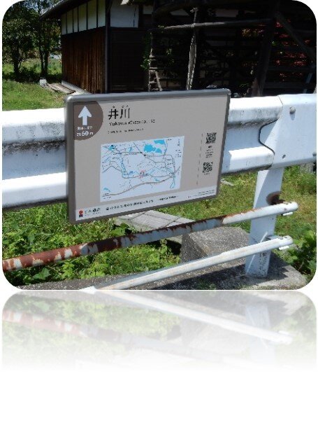
Installation location:
Guardrail at the Furukawabashi Bridge .
From its inception point at the Tsuchimaru Sluice Gate, the Yukawa Watercourse passes through the grounds of Hine Jinja Shrine and Jigen-in Temple before reaching its destination of Junidaniike Pond. The watercourse was engineered to let water flow over a total length of approximately 2.75 kilometers with a change in elevation of about 3 meters. It continues to serve as the main watercourse in the Hineno area for irrigation in a wide geographical area.
Pillar Sign of Amazuike Pond
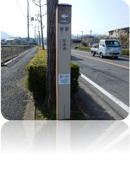
Installation location:
The prefectural road in front of Amazuike Pond entrance.
This pond is believed to have been Amazukeike Pond, which already existed when Hinenosho was formed in 1234, and to have served as a driving force for the development of the area of Hineno Village. The watercourses flowing from Amazuike Pond are still used for irrigation across an area that extends to the Yukawa Watercourse.
Pillar Sign of Yaejiike Pond
Installation location:
The city road in front of Yaejiike Pond entrance.
This pond is believed to have already existed under the name of Yaeike Pond when the Hinenosho estate was established in 1234. It is also depicted in the Painting of Hineno Village. Today, Yaejiike Pond is connected to Oike Pond, Amazuike Pond, Junidaniike Pond and other ponds, forming a single integrated water system.
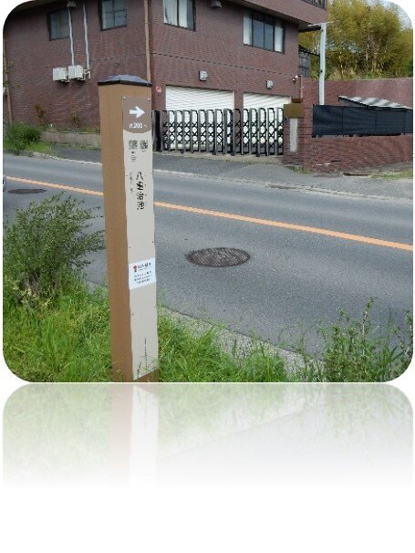
Signboard of Junidaniike Pond
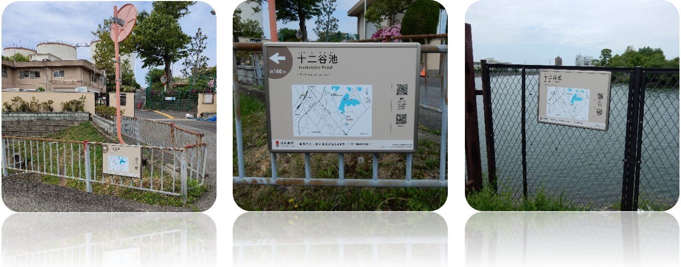
Installation location:
① The Fence in front of the Waterworks Bureau
② The fence of Junidaniike Pond
Water was drawn from Kashiigawa River via the Yukawa Watercourse for the irrigation of paddy fields across a wide area extending from Hineno area. According to a surviving archive document, Junidani-Shinike Pond (Shitaike Pond) was constructed in 1441, and the villages of Hineno, Ihara and Dambaramitsuji entered into an agreement for shared use of the pond.
Pillar Sign of Aritoshi Jinja Shrine
Installation location:
Next to the hall of worship.
Although the date of its foundation is unknown, according to its own history, it was founded to enshrine deities under the reign of Emperor Kaika, the ninth emperor. It was referred to as "Aritoshi Jinja Shrine" in "Izuminokuni Jinmyocho" in 1289 and was depicted as "Anatoshisha" in two paintings of the shoen.
It was originally located along the Kumano Kaido but was moved to its current location following the construction of the Akeno Army Aviation School Sano Air Field during the Pacific War.